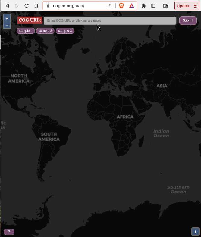
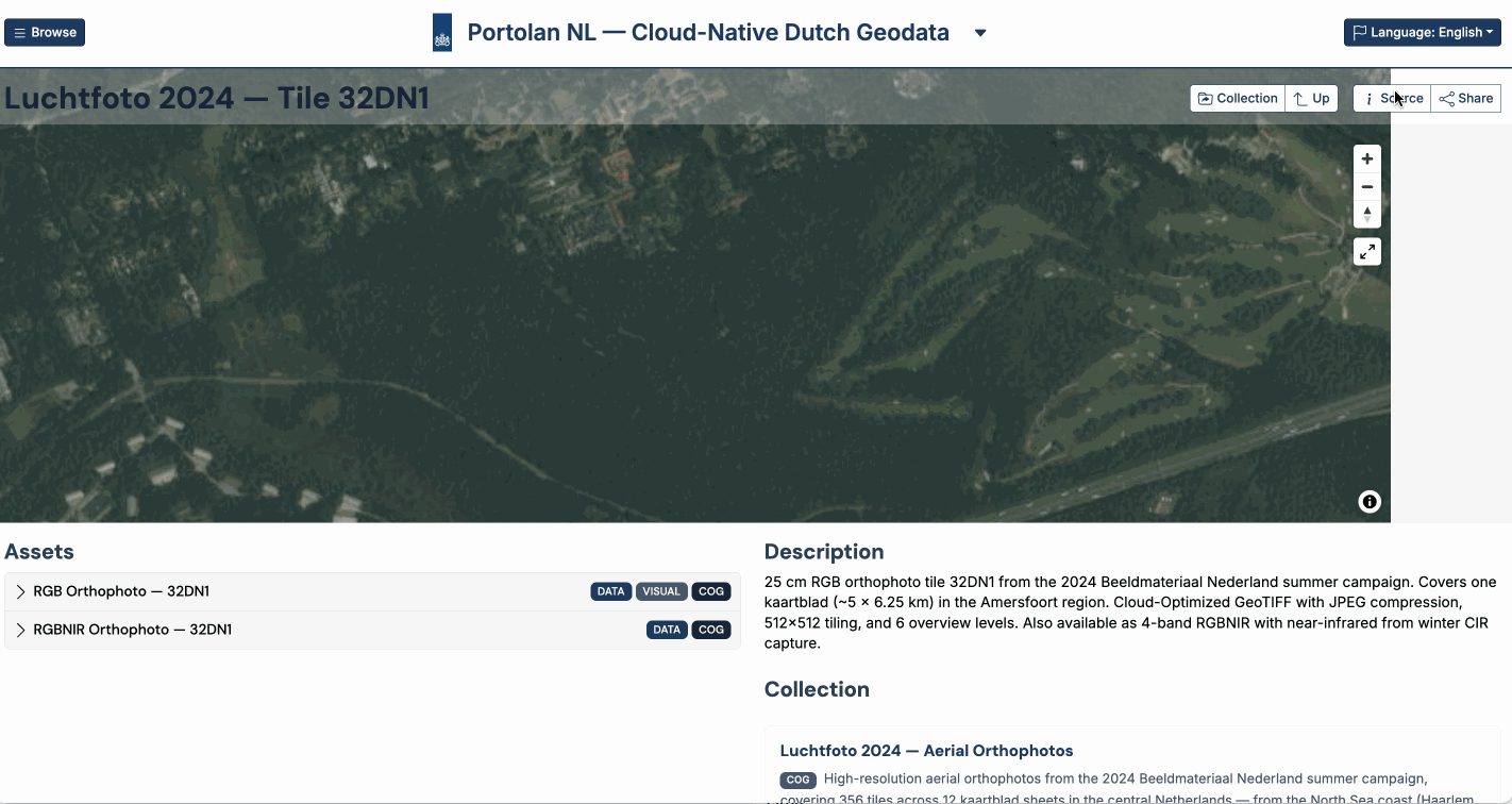
COG
Cloud-Optimized GeoTIFF
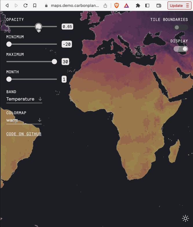
Zarr
Cloud-Native Arrays
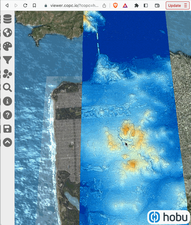
COPC
Cloud-Optimized Point Cloud
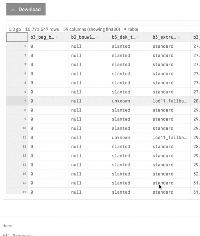
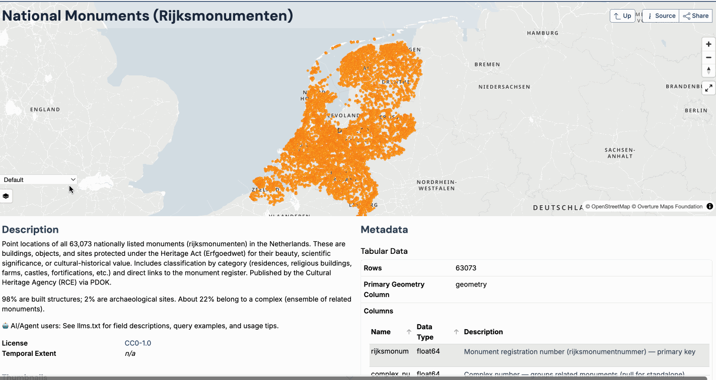
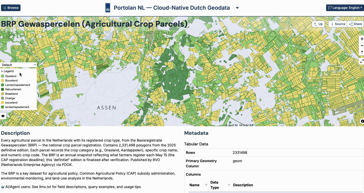
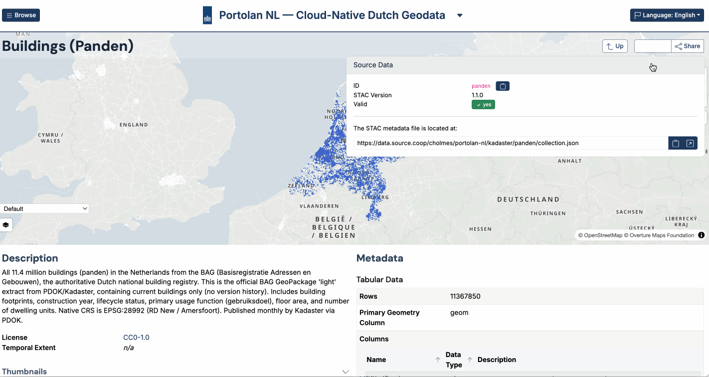
GeoParquet
Columnar Vector Format
PMTiles
Single-File Tile Archive
STAC
SpatioTemporal Asset Catalog
COG
Cloud-Optimized GeoTIFF
Stream raster data for visualization and analysis with just HTTP range requests — no tile server needed.
Still a valid GeoTIFF, so every legacy tool reads it exactly as before.
Zarr
Cloud-Native Array Format
Cloud-native format for multi-dimensional data cubes — think HDF5 or NetCDF, built for the cloud.
Not backwards compatible like COG/COPC, but getting great traction in climate and earth science.
ESA is adopting Zarr for all Copernicus Sentinel missions.
COPC
Cloud-Optimized Point Cloud
Stream point clouds for visualization and analysis — the COG equivalent for LiDAR data like AHN.
Still a valid .laz file, so it works with all existing LiDAR tools without conversion.
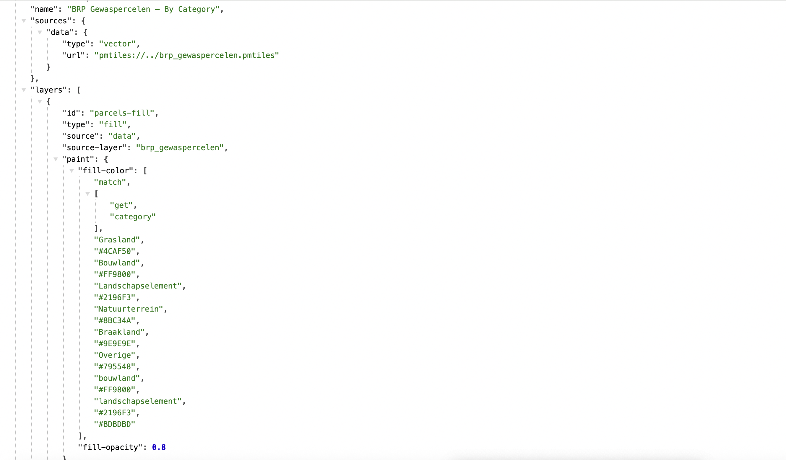
GeoParquet
Columnar Geospatial Format
The cloud-native format for vector data analysis — query with SQL, no server needed.
Tools like DuckDB and Pandas read it natively, making AI integration natural.
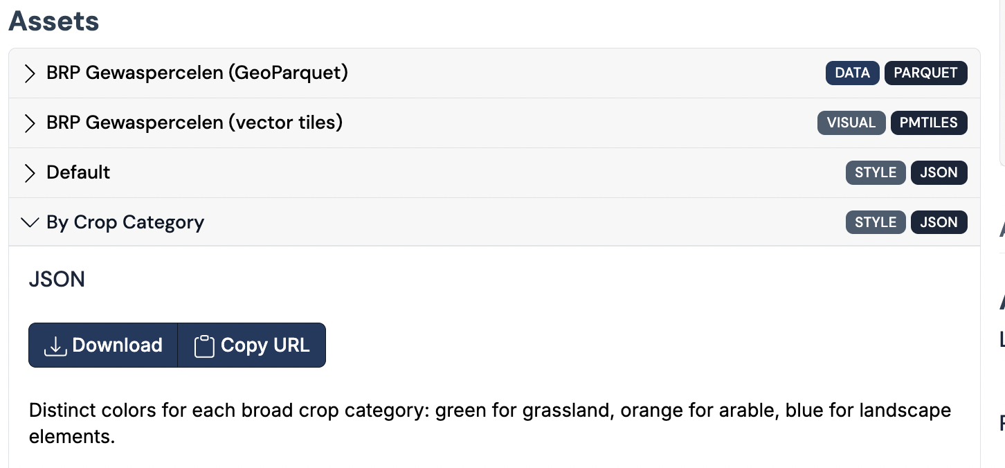
PMTiles
Single-File Map Tile Archive
Packages map tiles into one file for visualization — no tile server needed.
Complements GeoParquet and COG: they handle analysis, PMTiles handles display.
STAC
SpatioTemporal Asset Catalog
Simple JSON format that adds metadata to any cloud-native format.
Search collections and items with STAC API or serverless with STAC-GeoParquet.
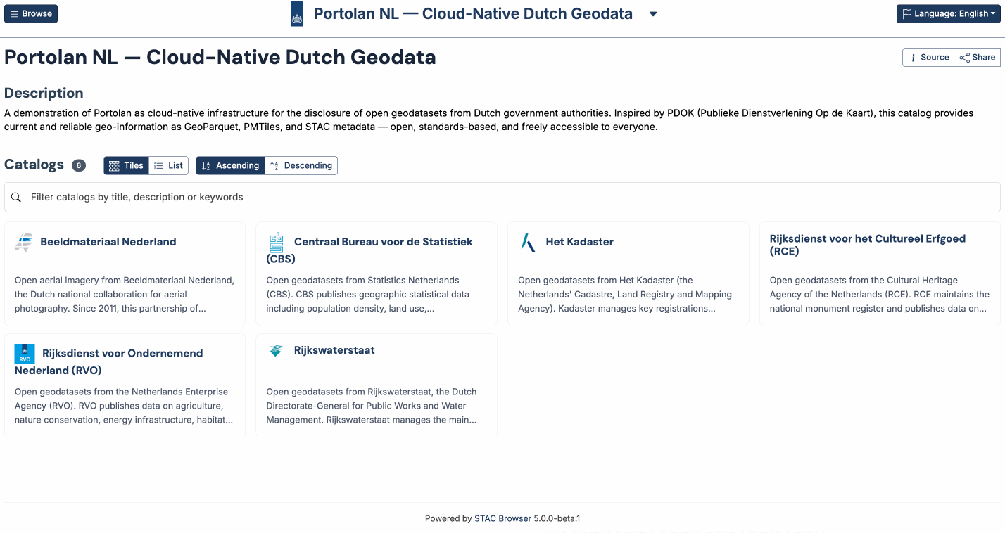
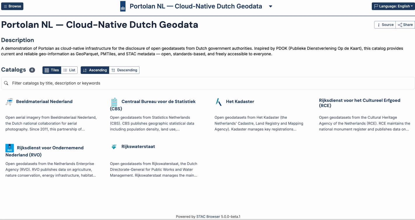
Cloud-Native Spatial Data Infrastructure
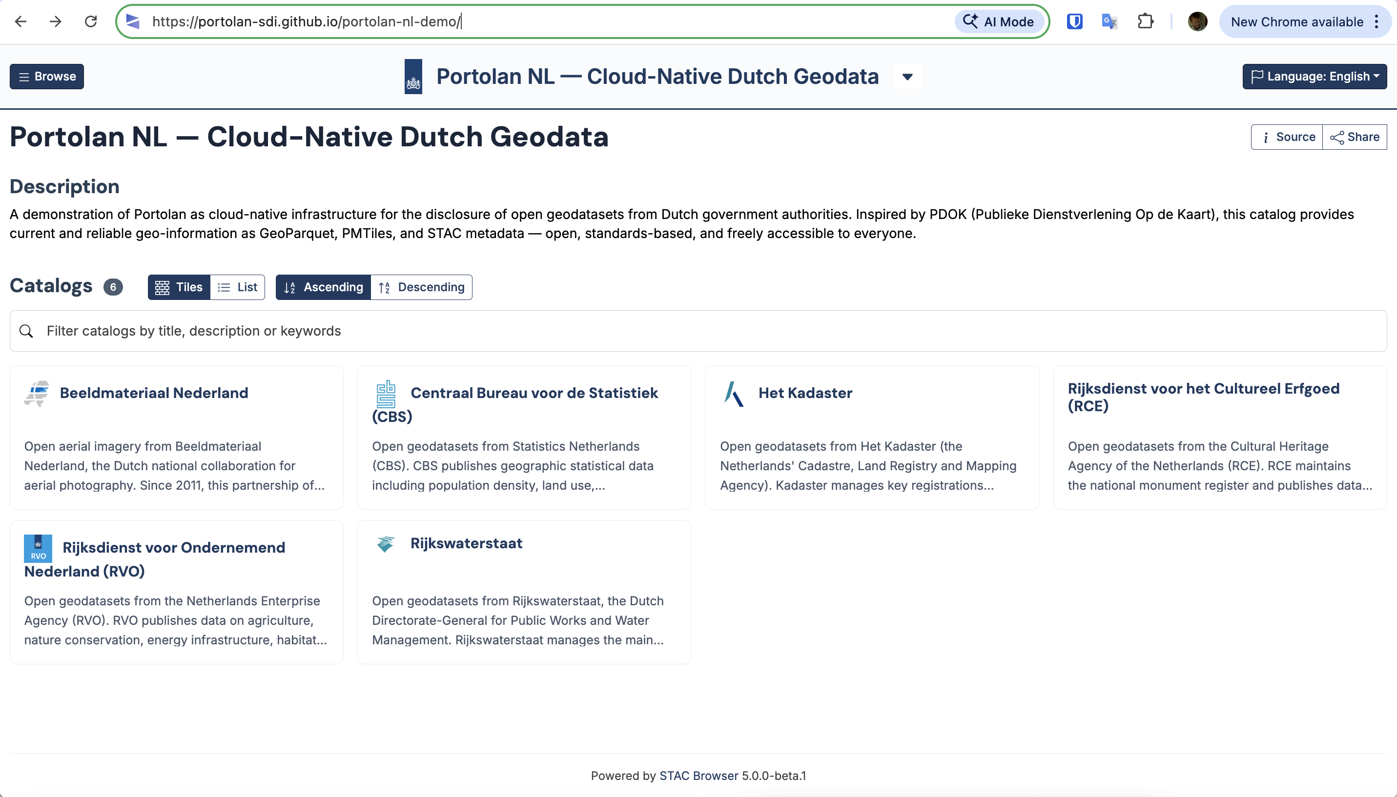
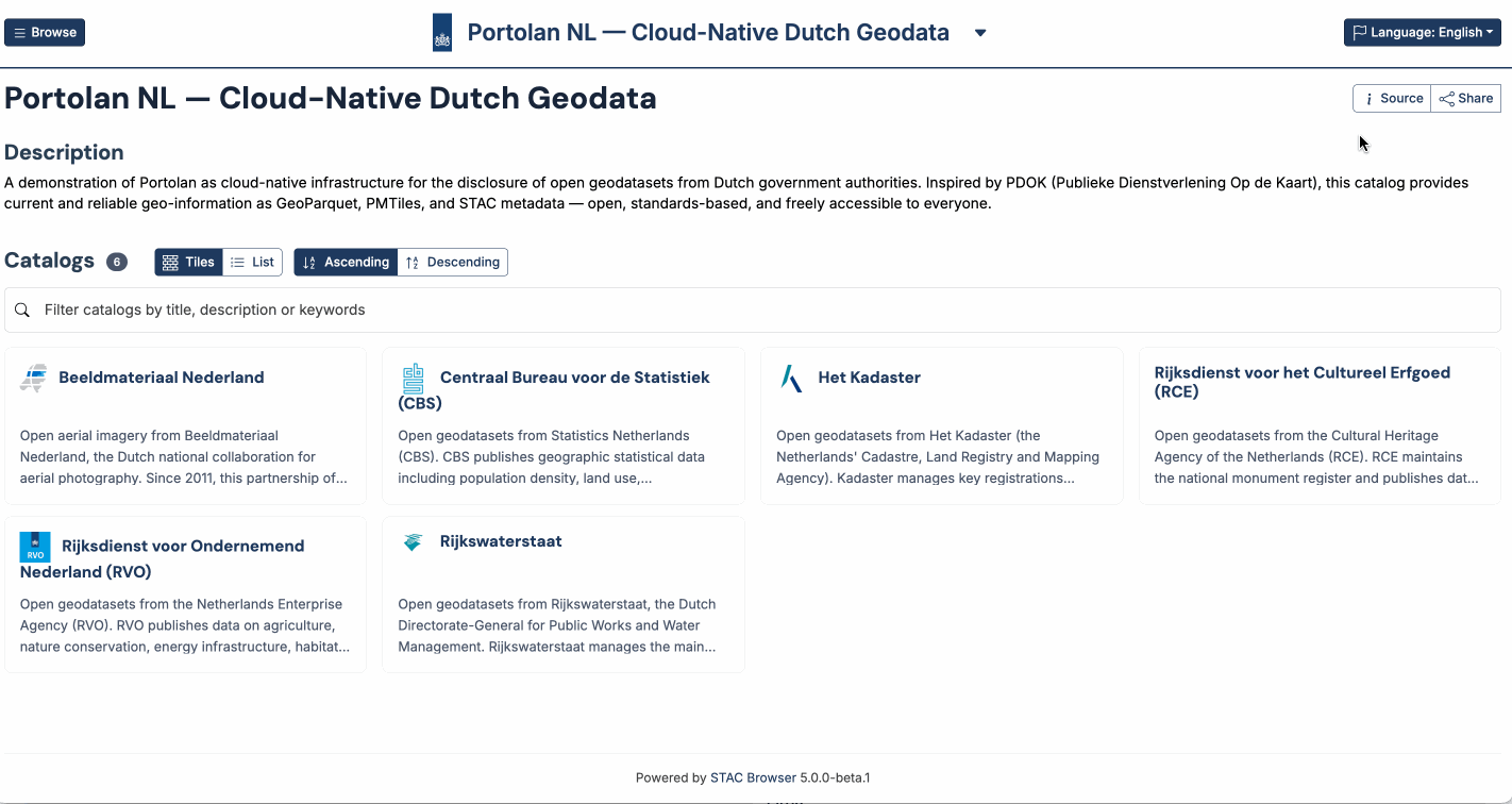
Portolan
A new foundation for sharing geospatial data — faster, cheaper, and built for the age of AI.
Explore the demo live
portolan-sdi.github.io/portolan-nl-demo

Explore the demo live
portolan-sdi.github.io/portolan-nl-demo


European digital
sovereignty
sovereignty
No foreign vendor in the stack — 100% open source, no servers.
Cloud-native just needs S3-compatible storage — many European providers qualify.
Leaseweb
Netherlands 🇳🇱
Hetzner
Germany 🇩🇪
Scaleway
France 🇫🇷
OVHcloud
France 🇫🇷
IONOS
Germany 🇩🇪
MinIO
Self-hosted
Any S3-compatible storage
Get the talk and explore the demos at
cholmes.github.io/open-geodag-presentation
